blah blah blah
Oak Hill (Washington)
Length: 1.6 miles out-and-backDifficulty (click for info): Easy
Elevation Gain: 380 feet (+60 feet on return)
Rating (click for info): 6/10
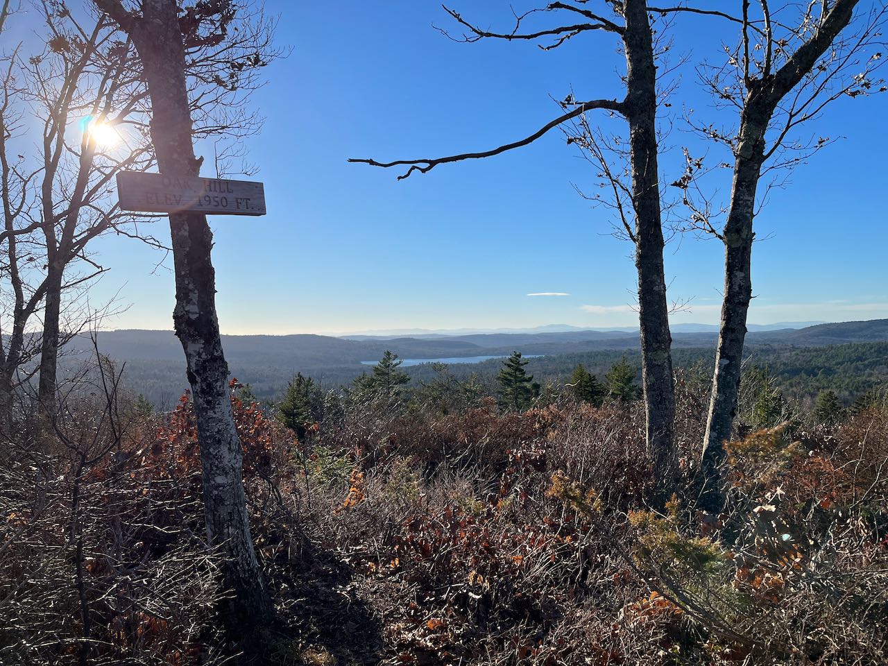
Elevation: 1959'
Prominence: 335'
Driving Directions:
Trailhead is on Faxon Hill Road in Washington, NH. Faxon Hill Road leaves Rt. 31 9.2 miles north of Rt. 9 and 8.9 miles south of Rt. 10. From the center of Washington, across from the church and town offices, drive west from the triangle junction. The trailhead is at a wooden gate 1.7 miles down the road, on the left side, in between Pine Point Road and Old Haying Road (both on the opposite side). Pull off the road and park outside the gate. Beyond the gate, the trail passes through private property. Click here for a Google map.
About the Hike:
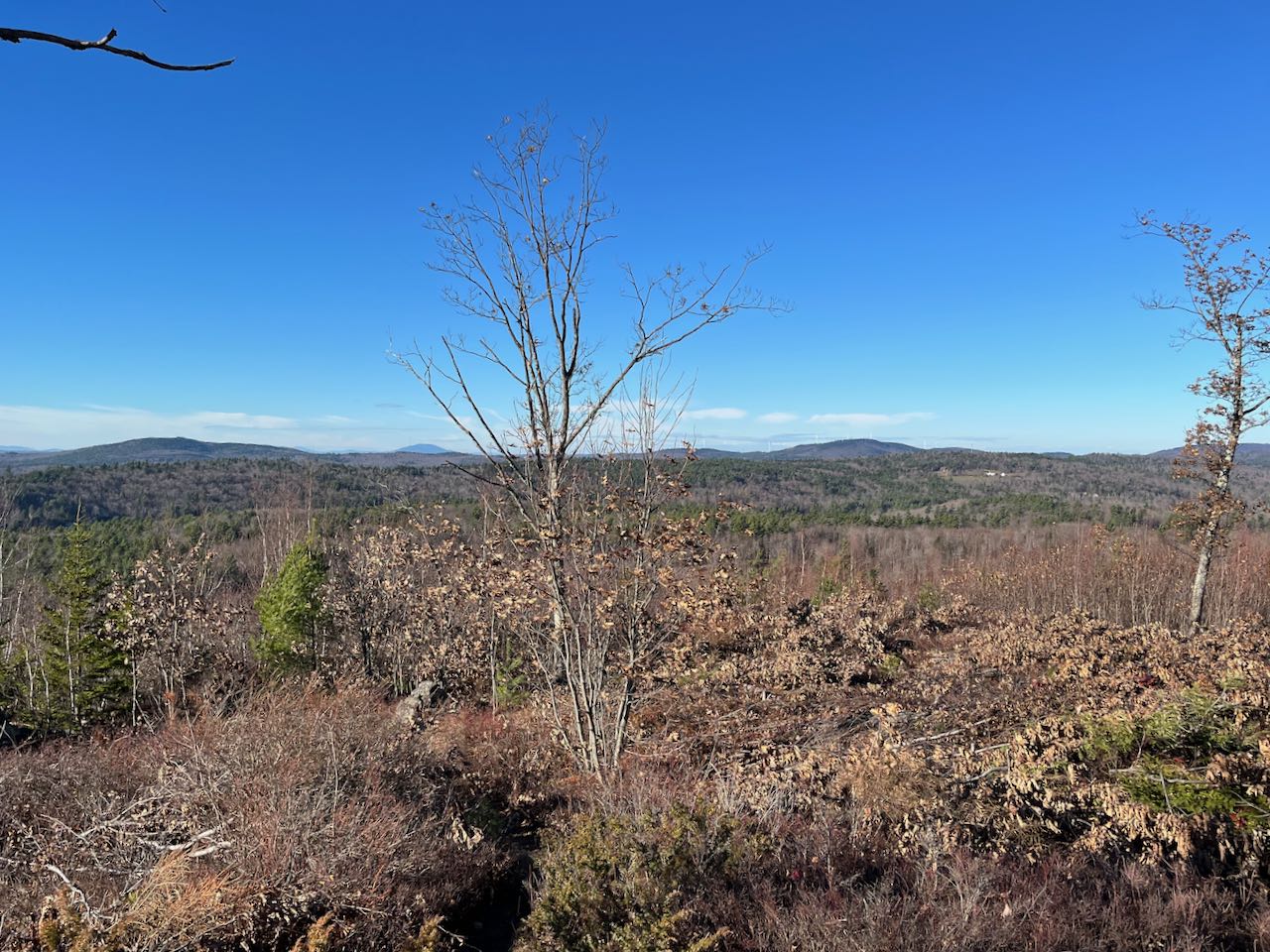
Little effort is required to enjoy the spectacular view found on the cleared summit of this small mountain just outside the town center of idyllic Washington, NH. Its sub-2000' rise would not offer any scenic attraction without the benefit of an expansive clearing which bares much of the hillside. This opening is kept trimmed to maintain the view. It's easy to enjoy a relaxing afternoon taking in the panoramic vista encompassing the surrounding hills, mountains, and lakes. Oak Hill receives a measure of attention due to its being traversed by the Monadnock-Sunapee Greenway, one of southern NH's premiere long-distance trails. It's a very brief segment of this trail that will take you up to the top of the hill.
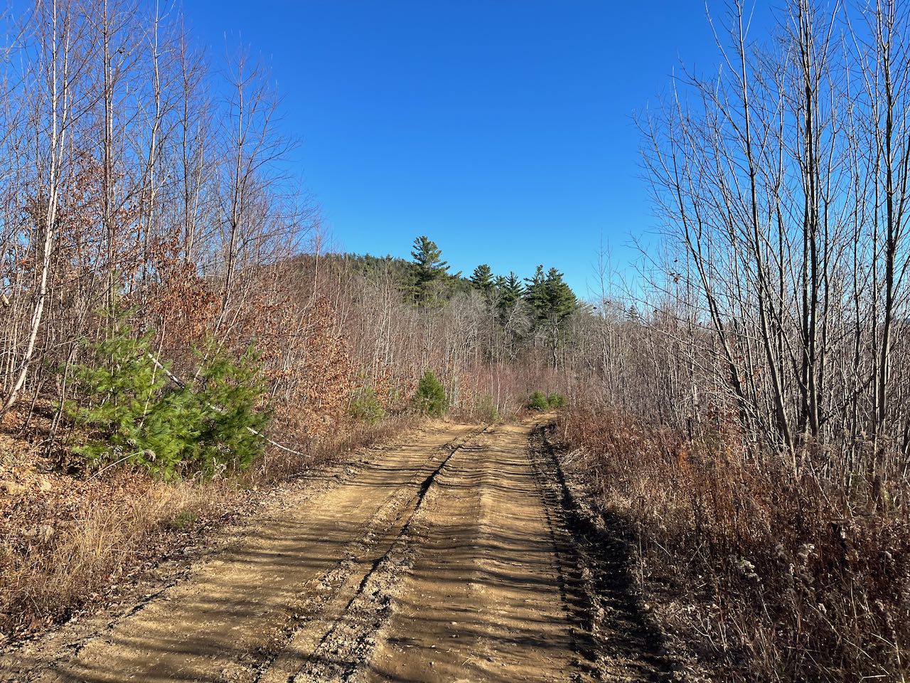
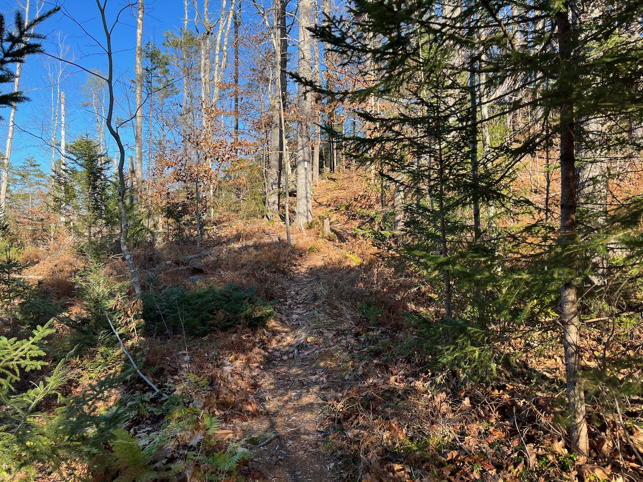
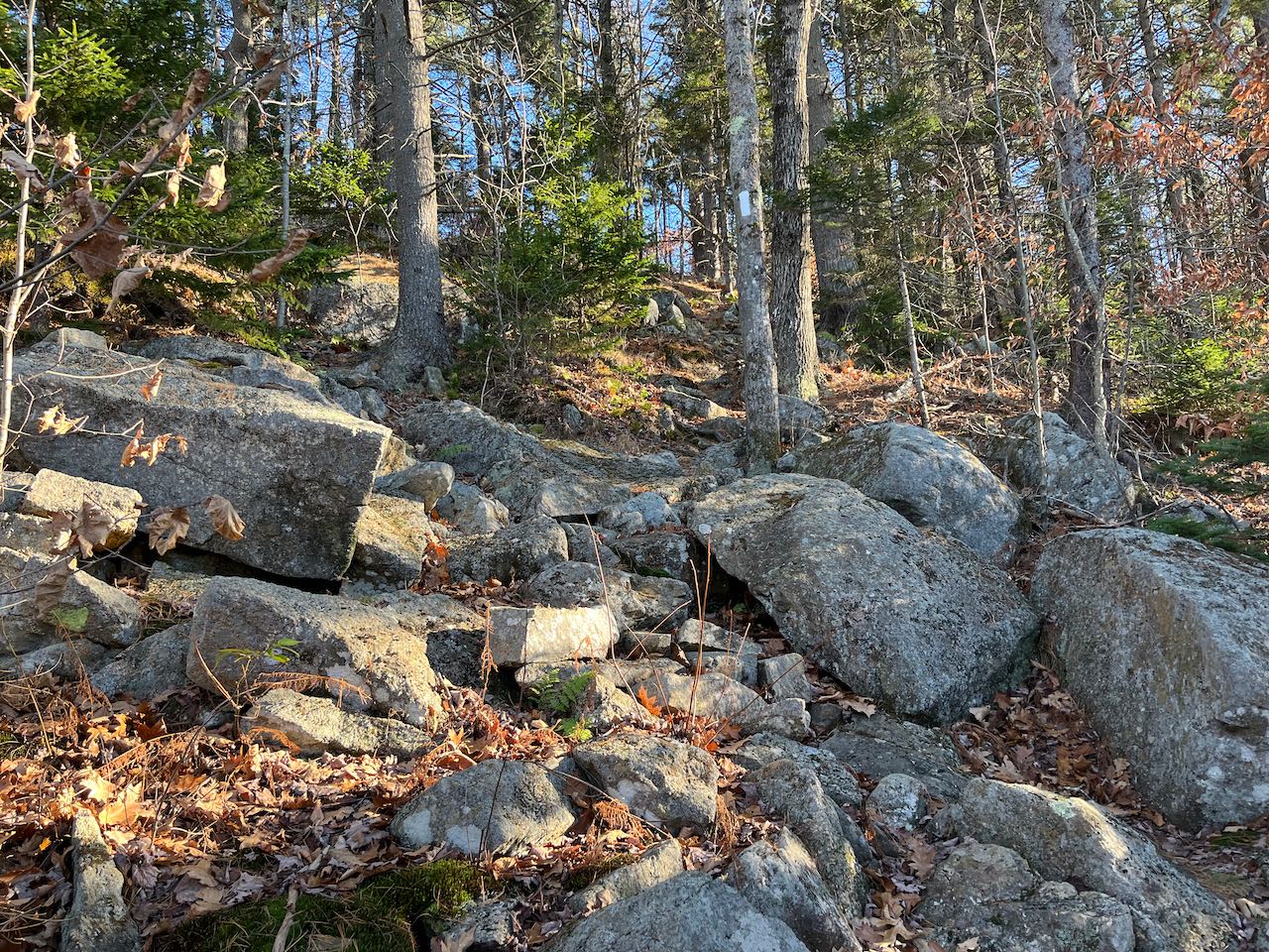
From your parking spot at the gate, head down the logging road, passing by a house and walking downhill for 0.15 miles into regrowing stands of trees. The summit of the hill is seen over the treetops. You will spend the entire hike in and around various stages of logging activity. Take a left off the road at an arrow sign and makeshift bridge and cross over a stone wall. Passing a conservation land marker, the pathway follows the stone wall for a bit, slides beside a boulder, and crosses a little stream after another 0.15 miles. Having reached the foot of the hill, the trail begins uphill gradually, soon crossing through open logging areas. Weaving through bands of trees in between the openings, the trail nears the base of the view clearing around the top in 0.3 miles. Steepening, it ascends on a straight course up the rocky hillside, soon breaking into the open and reaching the picturesque summit amidst a grove of oak trees in 0.15 miles.
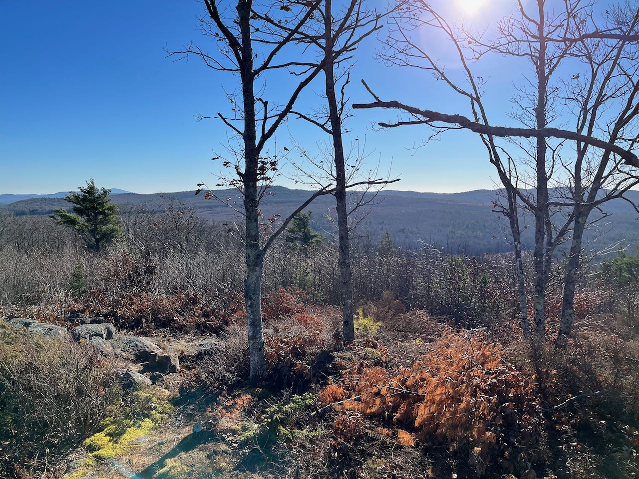
Wander around the meadow-like summit to explore the various perspectives in different directions. All the way to the left, to the south, you have a view of Mt. Monadnock and the Wapack Range. Over to the southwest, you can see nearby Pitcher and Jackson Hills, which carry the Greenway southbound. The centerpiece of the view is Ashuelot Pond, over which appear the southern Green Mountains of Vermont in the distance. Then toward the northwest, you see a couple local hills, including Huntley Mountain (L) and Silver Mountain (R). In the distance to the right of Silver, you can see Mt. Ascutney. Further over are the wind turbines lining the Lempster Mountain ridge. Out to the north, the low ridge from Lovewell Mountain to Mt. Sunapee stretches across the view.
Printable directions page